Select a Layer Category
Aircraft Chlorophyll
Aircraft Estimated Cells
Added Aircraft Layers
Please Select a Basemap
Search for Station
Please select the station you wish to look at
Real-Time Station Table - ↑↓: 24 hour trend
Notes: “Chloro”: Chlorophyll a ; “Phyco”: Phycocyanin
| Waterbody / Site | DO | Chloro | Phyco | pH | Temperature |
|---|
Note: 24 hour trend calculated by comparing the prior 24 hour period from current date/time to the prior 24-48 hour period from current date/time.
Graphing
Please select a site from the map and click the “Graphing” Button.
If you would like more controls or filters for this dataset, please go to the Advanced Graphing page.
Download
Please select a site from the map and click the “Download” Button.
If you would like more controls or filters for this dataset, please go to the Advanced Downloading page.
Note: Only QA’d data can be downloaded.
Selected Station
Station: $buoy_name
Buoy Name: $buoy_name
Description: $buoy_desc
Affiliation: $affiliation Link
County: $county
Municipality: $municipality
QA Time Range: $start_date to $end_date
Download QA’d Data CSV:
Legends for Map
Flood Hazard Overlays
Save / Share / Print
Save / Share
Permalink
Create a permanent link of your current map for sharing
Temporary Map Url
Use this link if you’re not ready to make your options a permanent link.
No Layers are selected
Historical Stations
Show stations with data over 5 years old.
Filter Long-Term Stations by Latest Real-Time Result within Last 12 months
1. Select Variable
2. Select Comparison Type
3. Enter a numeric value
Active Filters
Layer Control Information
Map layers added to the map will appear in this window. The ordering of the layers on map can be controlled by clicking the up and down arrows next to each layer (when more than one layer is added). Layers can be temporarily turned on and off by clicking the appropriate button underneath the layer name.
Click the Remove button to remove the layer from the map. The transparency/opacity of each layer can be controlled with the slider below the layer name with 0% being fully transparent and 100% being fully opaque.
Basemaps
View unlisted / other basemaps here: Web Map Sources
-
 Imagery: Source Here
 -
 Imagery Hybrid: Source Here
 -
 Streets: Source Here
 -
 Topographic: Source Here
 -
 Navigation: Source Here
 -
 Streets (Night): Source Here
 -
 Terrain with Labels: Source Here
 -
 Light Gray Canvas: Source Here
 -
 Dark Gray Canvas: Source Here
 -
 Oceans: Source Here
 -
 National Geographic Style Map: Source Here
 -
 OpenStreetMap: Source Here
 -
 Charted Territory Map: Source Here
 -
 Community Map: Source Here
 -
 Navigation (Dark Mode): Source Here
 -
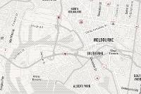 Newspaper Map: Source Here
 -
 Human Geography Map: Source Here
 -
 Human Geography Dark Map: Source Here
 -
 Modern Antique Map: Source Here
 -
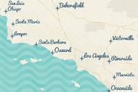 Mid-Century Map: Source Here
 -
 Nova Map: Source Here
 -
 Colored Pencil Map: Source Here
 -
 Watercolour Map: Source Here
 -
 USA Topo Maps: Source Here
TITLE
NJDEP Continuous Data Monitoring Program
In addition to its many discrete monitoring programs, the Division of Water Monitoring & Standards (DWM&S) also manage numerous continuous monitoring activities that involve the use of short and long term data loggers throughout NJ in both fresh and marine waters.
Data loggers are electronic devices that utilize sensors and probes to measure various water quality parameters 24 hours per day, 7 days per week. Parameters measured can vary from unit to unit and may include Dissolved Oxygen, Temperature, Chlorophyll, Phycocyanin, pH, Turbidity, Specific Conductance, Salinity, and Dissolved Oxygen %. Data logger deployments may range from several days to many months and are located in lakes, streams, and bays throughout NJ. In some cases, the data loggers transmit real-time parameter values every 15 minutes.
This continuous monitoring data is used to: (1) Support the Harmful Algal Bloom (HAB) Monitoring initiative developed to protect public health. Chlorophyll, Phycocyanin pigment, pH and Dissolved Oxygen are used to monitor the changing conditions of an algae bloom so that when needed, appropriate actions can be taken. (2) Measure fluctuations of Dissolved Oxygen and Temperature to determine the ecological health of streams. (3) Generate data to be used in the New Jersey Integrated Water Quality Monitoring and Assessment Report (Integrated Report). Every two years, a new water region in NJ is given a comprehensive monitoring and assessment focus which requires new continuous monitoring site selection.
On this website, users will find the locations of DWM&S managed continuous monitoring activities – both long and short term, active and historical, as well as information specific to each location. Data associated with each location is available for download and graphing. In addition, users will find continuous data generated by various DEP partners also involved with continuous monitoring.
Real-Time Station Trending Table
| Waterbody | Site | Phycocyanin | DO | Chlorophyll a | pH | Temperature |
|---|
NOTE: Provisional Data Subject to Revision
Real-time data displayed in the station dialog box are provisional and subject to revision until data has been thoroughly reviewed and approved.
Provisional data may be inaccurate due to instrument malfunctions or physical changes at the measurement site. Revisions to this data may occur as a result of field and equipment inspections.
Users are cautioned to consider carefully the provisional nature of the data before using it for decisions that concern personal, public safety, or business related activities.